File:VCT orthographic.svg

Size of this PNG preview of this SVG file: 600 × 600 pixel. Adda resolution: 240 × 240 pixel | 480 × 480 pixel | 768 × 768 pixel | 1,024 × 1,024 pixel | 2,048 × 2,048 pixel.
Original file (SVG fail, naminali 600 × 600 pixl, fail saiz: 1.25 MB)
Somari
| Diskripshan |
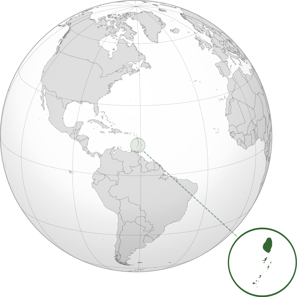
English: Orthographic map of Saint Vincent and the Grenadines centered at 17° N, 62° W.
Official territory.
Claimed territories. |
| Diet | |
| Suos | Uon wok with Natural Earth Data |
| Aata | Addicted04 |
| SVG genesis |
Laisnsin
I, the copyright holder of this work, hereby publish it under the following license:
Dis fail laisn anda di Creative Commons Attribution-Share Alike 3.0 Anpuotid laisn.
- Yu frii:
- fi shier – fi kapi, dischribiut ah chranzmit di wok
- fi riimix – fi adap di wok
- Anda di falarin kandishan:
- attribution – Yu fi achribiut di wok di wie spesifai bai di aata ar laisnsa (bot no ina no wie we sojes se deh indaas yu ar yu yuus a di wok).
- shier-shier siem wie – Ef yu alta, chansfaam, ar bil pah dis wok, yu kiah dischibiut di wok we rizolt onggl anda di siem ar simla laisn laka dis wan.
File history
Ef yuh waan see wah di file look like dem time deh, click pon dat date/time.
| Date/Time | Thumbnail | Size | User | Comment | |
|---|---|---|---|---|---|
| lates' | 17:35, 8 July 2012 | | 600 × 600 (1.25 MB) | Addicted04 |
Weh part di file use
Da page yah use dis file:
Weh part di file deh
Dis ya file use inna dem ya wiki:
- Weh part it deh pon af.wikipedia.org
- Weh part it deh pon ar.wikipedia.org
- Weh part it deh pon arz.wikipedia.org
- Weh part it deh pon ast.wikipedia.org
- Weh part it deh pon az.wikipedia.org
- Weh part it deh pon bg.wikipedia.org
- Weh part it deh pon bi.wikipedia.org
- Weh part it deh pon ca.wikipedia.org
- Weh part it deh pon cdo.wikipedia.org
- Weh part it deh pon ceb.wikipedia.org
- Weh part it deh pon ce.wikipedia.org
- Weh part it deh pon cs.wikipedia.org
- Weh part it deh pon da.wikipedia.org
- Weh part it deh pon diq.wikipedia.org
- Weh part it deh pon el.wikipedia.org
- Weh part it deh pon en.wikipedia.org
- Weh part it deh pon es.wikipedia.org
- Weh part it deh pon eu.wikipedia.org
- Weh part it deh pon fa.wikipedia.org
- Weh part it deh pon fi.wikivoyage.org
- Weh part it deh pon fr.wikipedia.org
- Weh part it deh pon fr.wiktionary.org
- Weh part it deh pon ga.wikipedia.org
- Weh part it deh pon gl.wikipedia.org
- Weh part it deh pon gn.wikipedia.org
- Weh part it deh pon hak.wikipedia.org
- Weh part it deh pon he.wikipedia.org
- Weh part it deh pon hy.wikipedia.org
- Weh part it deh pon ia.wikipedia.org
- Weh part it deh pon id.wikipedia.org
- Weh part it deh pon ie.wikipedia.org
- Weh part it deh pon incubator.wikimedia.org
- Weh part it deh pon is.wikipedia.org
- Weh part it deh pon it.wikipedia.org
- Weh part it deh pon ja.wikipedia.org
- Weh part it deh pon kab.wikipedia.org
Vyuu more global usage a dis fail.